Rural town
Gloucester: a historic country gateway to the World Heritage wilderness of Barrington Tops
Nestled in the foothills of the Buccan Buccans, Gloucester serves as a historic gateway to the World Heritage Barrington Tops. This rural town blends gold rush heritage with river adventures and hikes through ancient Gondwana rainforests.
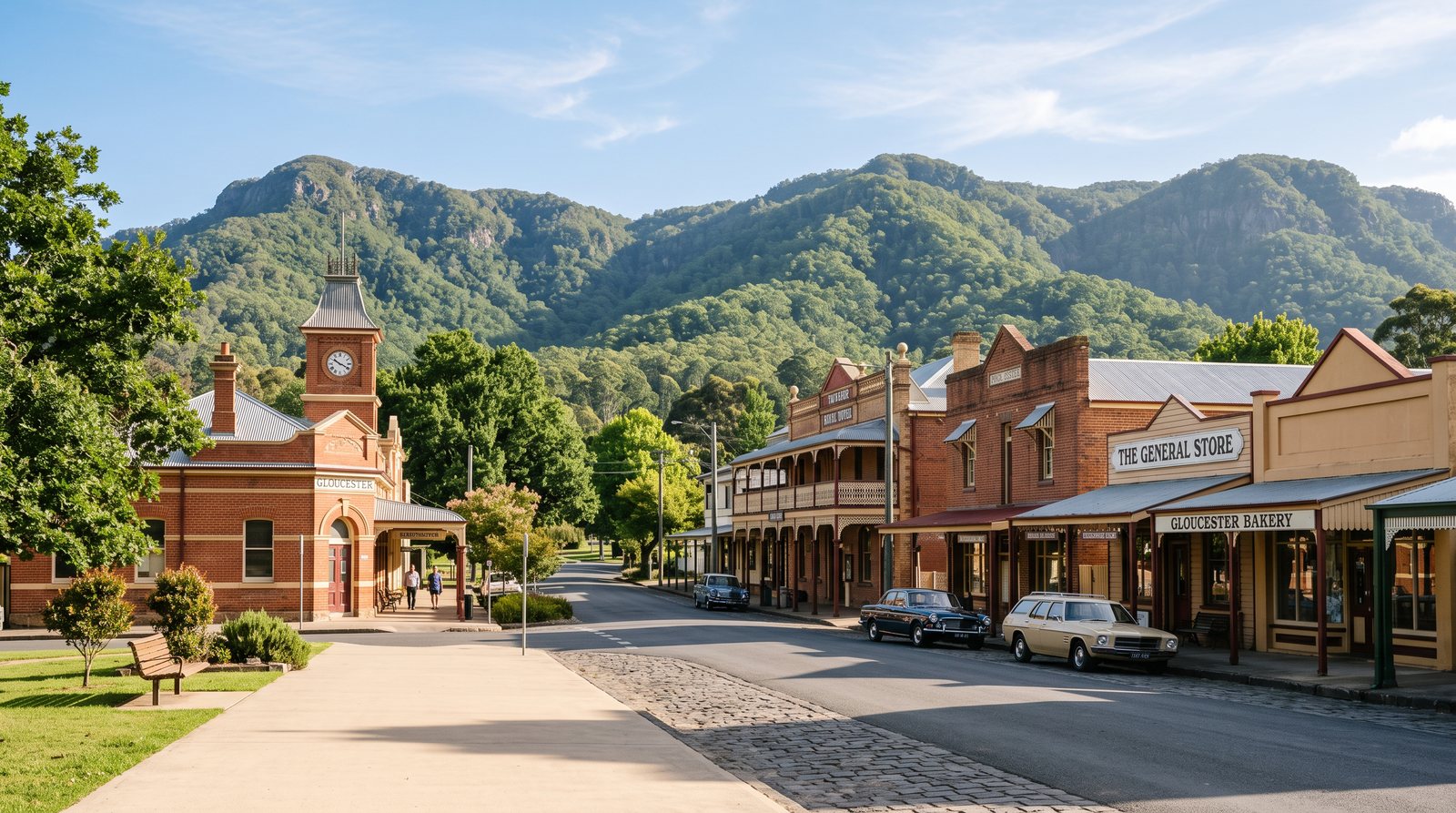
Nestled at the confluence of three mountain rivers, Gloucester serves as a vital gateway to the rugged Barrington Coast. The town is defined by its dramatic backdrop, where the jagged peaks of the Buccan Buccans rise sharply from surrounding dairy pastures. For visitors, Gloucester offers a transition from the rolling agricultural lands of the Hunter to the steep, mist-shrouded escarpments of the Great Dividing Range. The atmosphere is one of quiet permanence, where the pace of life is dictated by the seasons and the flow of the Gloucester, Barrington, and Manning rivers.
The Buccan Buccans are a site of deep cultural and geological significance. The name is derived from the Guringay language, where "Buccan" translates to "lots of rock," describing the weathered cliffs overlooking the town. These peaks were central to the Guringay people for millennia, serving as landmarks for travel and sites for ceremonies. Today, the Bucketts Mountains remain a popular destination for hikers and photographers, particularly at dawn when the first light illuminates the vertical rock faces. The climb to the summits reveals a complex landscape of scree slopes and hardy vegetation, offering panoramic views that stretch across the Gloucester Valley toward the distant heights of the Barrington Tops.
The history of Gloucester is inextricably linked to the discovery of gold, which transformed the pastoral district into a bustling mining hub in the late 19th century. In 1876, a man named Saxby discovered gold at Back Creek, sparking a rush that led to the establishment of the Copeland goldfields. The area, now known as Copeland Creek, became a hive of activity as miners sought their fortunes in the dense rainforest. The Mountain Maid mine remains a prominent relic of this era, representing a period when the district boomed with the arrival of thousands of prospectors. This heritage is preserved within the Copeland Tops State Conservation Area, where visitors can walk along the historic tracks that once facilitated the transport of ore through the steep terrain.
Beyond the town, the Copeland Tops offer a unique ecological transition zone. The Hidden Treasure track provides a window into this past, winding through rare dry rainforest that covers the slopes where gold was once extracted. Before the gold rush, the area was also a significant site for cedar logging, as early settlers sought the valuable "red gold" of the Australian bush. The removal of these giant trees opened the canopy, allowing for a diverse range of understory plants to flourish. Today, the conservation area protects a significant stand of rainforest, where the air is cooler and the sound of the wind in the canopy replaces the noise of the valley. The preservation of these sites ensures that the dual histories of resource extraction and conservation remain visible.
The ascent from Gloucester into the Barrington Tops National Park is a journey through time and climate. As elevation increases, the subtropical rainforests of the lower slopes give way to the cool temperate rainforests that have earned the region its World Heritage status as part of the Gondwana Rainforests of Australia. This wilderness area encompasses over 70,000 hectares of protected land, representing one of the most significant refuges for ancient plant and animal lineages in the country. The Barrington Tops plateau, sitting at over 1,500 metres above sea level, experiences a climate far removed from the humid coast, with frequent mists and occasional winter snowfalls. This high-altitude environment is a remnant of a much older Australia, providing a living link to the supercontinent of Gondwana.
One of the most iconic features of the Barrington Tops is the presence of the Antarctic beech, a tree species that serves as a biological indicator of the region's ancient origins. These massive, moss-covered trees can live for hundreds of years, often growing in circular groves that indicate where a single parent tree once stood. The cool, damp conditions of the plateau are essential for their survival, and they provide a habitat for a vast array of epiphytes, ferns, and fungi. Walking through an Antarctic beech forest is a sensory experience, where the soft ground and filtered green light create a cathedral-like atmosphere. These forests are scientifically vital, containing primitive plant taxa that show evidence of ongoing evolution dating back millions of years.
The biodiversity of the Barrington Tops extends beyond its flora to include a range of rare and threatened animal species. The park provides a critical habitat for birds such as the rufous scrub-bird and Albert's lyrebird, both of which are highly sensitive to environmental changes. These species rely on the dense leaf litter and complex structure of the rainforest for nesting and foraging. The high country is also home to the broad-toothed rat and the Barrington Tops frog, species that have adapted to the specific conditions of the plateau. For birdwatchers and naturalists, the region offers a rare opportunity to observe wildlife found nowhere else on Earth. The quietness of the forest is often broken by the complex calls of these birds, echoing through the gullies.
Water is the lifeblood of the Gloucester region, with the Barrington, Gloucester, and Manning rivers providing both a resource for agriculture and a playground for outdoor enthusiasts. These rivers originate in the high rainfall areas of the Barrington Tops, flowing through steep gorges before widening into the fertile valleys below. The crystal-clear mountain water is a hallmark of the area, making it a premier destination for kayaking, canoeing, and fly-fishing. Depending on the river height, paddlers can navigate sections of white water or enjoy a tranquil drift through the dairy country. The riverside trails also offer opportunities for horse riding and picnicking, allowing visitors to engage with the landscape at a leisurely pace while observing the diverse aquatic life that inhabits these pristine systems.
As the ultimate basecamp for the Barrington Coast, Gloucester provides the necessary infrastructure for exploring one of New South Wales' most diverse natural areas. The local information centre is an essential first stop, offering maps and expert advice on the current conditions of the park's extensive trail network. Many of the roads leading into the high country are unsealed and can become challenging during periods of heavy rain, making preparation a key part of any visit. By respecting the environment and following the guidance of park authorities, visitors can safely experience the connection between the town's gold rush heritage and the ancient wilderness of the Barrington Tops. Gloucester remains a place where the history of the land and the stories of its people are woven together.