Coastal town
A coastal haven where the Clyde River meets the Pacific tides
At the confluence of the Clyde River and the Pacific Ocean, Batemans Bay serves as a gateway to the Eurobodalla, where the patient rhythms of oyster farming and the rugged beauty of new coastal trails define a town shaped by the tides.
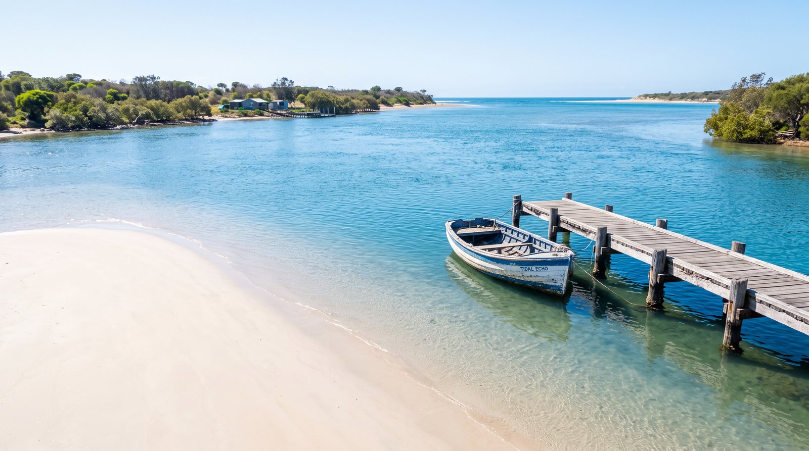
The transition from the Budawang Range to the Tasman Sea is most precise at Batemans Bay. Here, the Clyde River—known as Bhundoo to the Walbunja people—concludes its journey through protected wilderness, carrying clear, nutrient-rich water into a broad estuary. This meeting point defines a town that has long balanced its role as a regional gateway with a deep reliance on the patient cycles of the tide. The estuary is a tide-dominated drowned valley, a designation accounting for the clarity and salinity sustaining the local ecology. For the visitor, this intersection is visible where urban infrastructure gives way to the horizontal lines of the river and sea, creating a space both industrial and natural.
The purity of the Clyde River stems from its passage through protected national parks, ensuring water quality rare in New South Wales. This clarity sustains the oyster industry, which has operated along the river for over a century. Cultivating Sydney Rock Oysters is a multi-generational pursuit; families like the Norrises have maintained leases for four generations. The process requires constant monitoring of salinity and temperature to ensure crop health. The resulting oysters are prized for a clean, mineral-heavy flavor, reflecting the pristine wilderness upstream. The "oyster sheds" along the riverbank provide a functional aesthetic, where shucking remains a daily ritual visible to anyone walking the foreshore.
Infrastructure in Batemans Bay is defined by the challenge of crossing the Clyde. The history of these crossings traces a technological evolution from manually operated punts in 1871 to petrol-powered and steam vessels. The new Batemans Bay Bridge, completed in 2021, has fundamentally altered the skyline. Its modern silhouette contrast with the rusted ironwork of the past, yet it serves the same purpose: connecting the Princes Highway to the Eurobodalla. At sunset, the bridge becomes a focal point, offering a vantage point over the river’s mouth and the oyster leases, reminding residents of the town’s dual identity as a transport hub and maritime sanctuary.
Beyond the center, the region’s ecological complexity is preserved in the Cullendulla Creek Nature Reserve. Home to significant mangrove systems, it provides a nursery for marine life and a buffer against erosion. Boardwalks allow visitors to move through saltmarsh and forests without disturbing the substrate. It is a place of quiet observation, where the tide is measured by the exposure of aerial roots and bird activity. Kayaking these channels offers a different perspective, revealing the hidden interior where highway noise is replaced by the rhythmic splash of water. Preserving these spaces is essential for the Clyde’s long-term health, ensuring biological diversity remains intact as the town expands.
The Munjip Trail, opened in 2025, offers a new way to experience the coastline south of the river. Stretching fifteen kilometers from Batehaven to McKenzies Beach, the trail traverses spotted gum forests, secluded coves, and dramatic headlands. The name honors local Aboriginal heritage, and the path is a journey through natural and cultural history. Walking the trail requires moderate fitness as terrain shifts from sandy tracks to steep sandstone ascents, but rewards with panoramic views of the Tollgate Islands. The trail serves as a physical link between residential fringes and wilder stretches, encouraging slow travel that emphasizes the geological and botanical details of the South Coast.
Batemans Bay is the primary service center for the Eurobodalla Shire, a role bringing energy to its streets. "Eurobodalla" means "land between waters," describing a region defined by rivers, lakes, and ocean. The economy blends traditional industries with a tourism sector valuing authentic character. Visitors are drawn to culinary experiences rooted in the landscape. The "farm-to-plate" ethos is a practical reality, with seafood markets sourcing directly from boats and leases visible from their windows. This economic model relies on environmental health, creating a powerful incentive for sustainable management of the river and surrounding bushland, ensuring the neighborhood has another way to meet the water.
The cultural landscape is rooted in the history of the Walbunja people, whose connection to Bhundoo spans millennia. For the Yuin Nation, the river is a source of life and a spiritual corridor. Recognition of this heritage is visible in public spaces and naming conventions, reflecting a commitment to acknowledging the land's deep history. The Munjip Trail and interpretive signage provide opportunities to learn about traditional plant uses and the river’s importance as a food source. This layering of history—from ancient indigenous connection to colonial industry and modern conservation—gives Batemans Bay a depth of character that transcends its reputation as a simple seaside destination.
As the sun sets, the town enters a different rhythm. Industrial activity slows, and bridge lights reflect in the darkening water. The "wistful" quality is most evident in these transitions, where past legacy and future possibilities are held in balance. The patient work of oyster farmers, the preservation of mangroves, and the development of new trails point toward a community valuing its natural assets. Batemans Bay remains a place where the tide is the ultimate authority, a reminder that some rhythms are worth preserving. The town’s endurance is found in the clarity of its water and the steady, quiet labor of those who call the Clyde their home.
The future of Batemans Bay will be defined by its ability to maintain this equilibrium. As climate patterns shift and regional growth increases, stewardship of the Clyde will become even more critical. Ongoing research into oyster health and habitat restoration are essential components of this effort, ensuring the "land between waters" remains a vibrant home. For the traveler, the town offers a lesson in the importance of place. It is a location where geography and history are inextricably linked, creating a coastal identity as resilient as the spotted gums and as clear as the water flowing from the mountains to the sea.